


Contact Info
Laconia, NH 03246
- Phone 1:
- 603-528-8721
- Phone 2:
- 603-528-8722
Basics
- Length:
- 2 miles one-way
- Difficulty:
- Intermediate
- Time:
- 1 hour
Description
From Bethel take Route 5 south past Songo Pond and turn right onto the Patte Brook Road at sign indicating National Forest Camping. Follow signs to Crocker Pond Campground. Travel 0.6 miles on Forest Road 18: the trailhead is on your right.
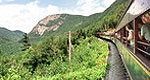
This trail leads to the summit of Albany Mountain, a series of rocky openings with panoramic views. It’s a popular spot for blueberrying in the summer and offers great views of colorful foliage in the fall.
Begin on the Albany Notch Trail, turning left onto the Albany Mountain Trail at 0.6 miles. At 0.9 miles from this junction, a connector trail leaves right, leading back to the Albany Notch Trail. Continue past this junction, ascending the north side of Albany Mountain as the trail begins crossing sections of open ledge and softwoods.

