


Basics
- Location:
- Londonderry, NH
- Length:
- 10 miles (16 km)
- Time:
- 1 hour
- Fees:
- No fees known.
Description
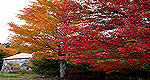
Apple Way, Londonderry is a 10-mile strip of road running through a land of orchards, old farm houses, and strawberry patches. Antiquated schoolhouses are splattered here and there along the way with a backdrop of pastoral beauty.
Beginning at the Londonderry Town Offices, take Gilcrest Road to Pillsbury Road (east). Follow Pillsbury Road to High Range Road then on to Elwood and Adams. Finally, take Mammoth (which loops back to the beginning of the route).
Enjoying a day in the country where maple syrup flows at Dutton Farm and berries are ripe for picking at Sunnycrest Farm is the highlight of the trip. In the spring, flowering fruit trees fill the air with an intoxicating aroma. And from spring to late fall, a harvest of fruit keeps the tourists coming.

