


Contact Info
Laconia, NH 03246
- Phone 1:
- 603-528-8721
- Phone 2:
- 603-528-8722
Description
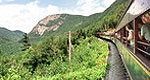
The Lincoln Woods Trail is one of the easiest and most heavily used trails on the White Mountain National Forest. It is a main route into the headwaters of the East Branch of the Pemigewasset River and leads into one of the largest roadless areas in the eastern United States known as the Pemigewasset Wilderness.
Backpackers, day hikers, fishermen, and mountain bikers all share this very popular multiple use trail. Motorized vehicles are prohibited. Summer is the heaviest use season, but with increased popularity of cross country skiing, the trail is also extensively used in winter. The fall season provides an excellent opportunity to enjoy hiking trails with cooler temperatures, fewer bugs, and fall foliage colors.
Details
Additional Details:
Location
The Lincoln Woods Trail parking lot (170 vehicle capacity) and Lincoln Woods Visitor Center are off the Kancamagus Highway 5 miles east of I-93, Exit 32. The 2.9 mile Lincoln Woods Trail begins at 1157 feet elevation and ends at the Wilderness boundary, 1450 feet elevation. Leaving the parking lot on the north side of the Kancamagus Highway, the Lincoln Woods Trail immediately crosses the East Branch of the Pemigewasset River via a 160’ long suspension bridge. The trail then makes a sharp turn to the right and for most of its length, follows the route of the old East Branch and Lincoln Railroad northerly to the boundary of the Pemigewasset Wilderness.
The Lincoln Woods Trail comes close to the river at 1.7 miles providing a nice view of Mt. Bond, and then crosses Birch Island Brook on a foot bridge at 1.8 miles. The Black Pond Trail diverges to the left at 2.6 miles, skirts around the northern edge of the ice pond, and provides an easy hike of 0.7 mile to picturesque Black Pond.
At 2.8 miles, the former Franconia Brook Campsite, now a Forest Protection Area, remains closed for health and safety reasons. An interim camping area with 24 sites has been established across the river on the northern end of the East Side Trail (truck service road). Camping in the Franconia Brook East temporary campsites is by permit only; no fee is charged. Sites are reservable.*
Past the former campsite is a stone wall and a narrow 75 foot bridge that crosses Franconia Brook. At the stone wall, a path veers left, leaving the trail, to follow the brook upstream 0.4 mile to scenic Franconia Falls, a large rock outcrop about an acre in size with cascading water. Franconia Falls restrooms have been closed. Unacceptable sanitary conditions and improper human waste disposal have caused general deterioration of this area. A sanitation kit is available for a nominal fee at the Visitor Center.
Non-fee Day Use Permits are required in the Franconia Falls area: Day use permits are valid only for a specific date and time. Only 60 users can be in the area at any given time. Reservations are accepted*. At least 30 walk-in slots will be available on a first come-first served basis. After crossing the bridge over Franconia Falls, the Lincoln Woods Trail ends and becomes the Wilderness Trail as it enters the Pemigewasset Wilderness.

